


Land Surveying
Measured Building Surveys
UAV Mapping & Aerial Surveys
Orthomosaic
Orthomosaics, captured via drone technology, revolutionize site mapping and analysis. These meticulously stitched-together aerial images offer a bird's-eye view of your site, presenting a detailed, true-to-scale representation of the terrain, structures, and features below
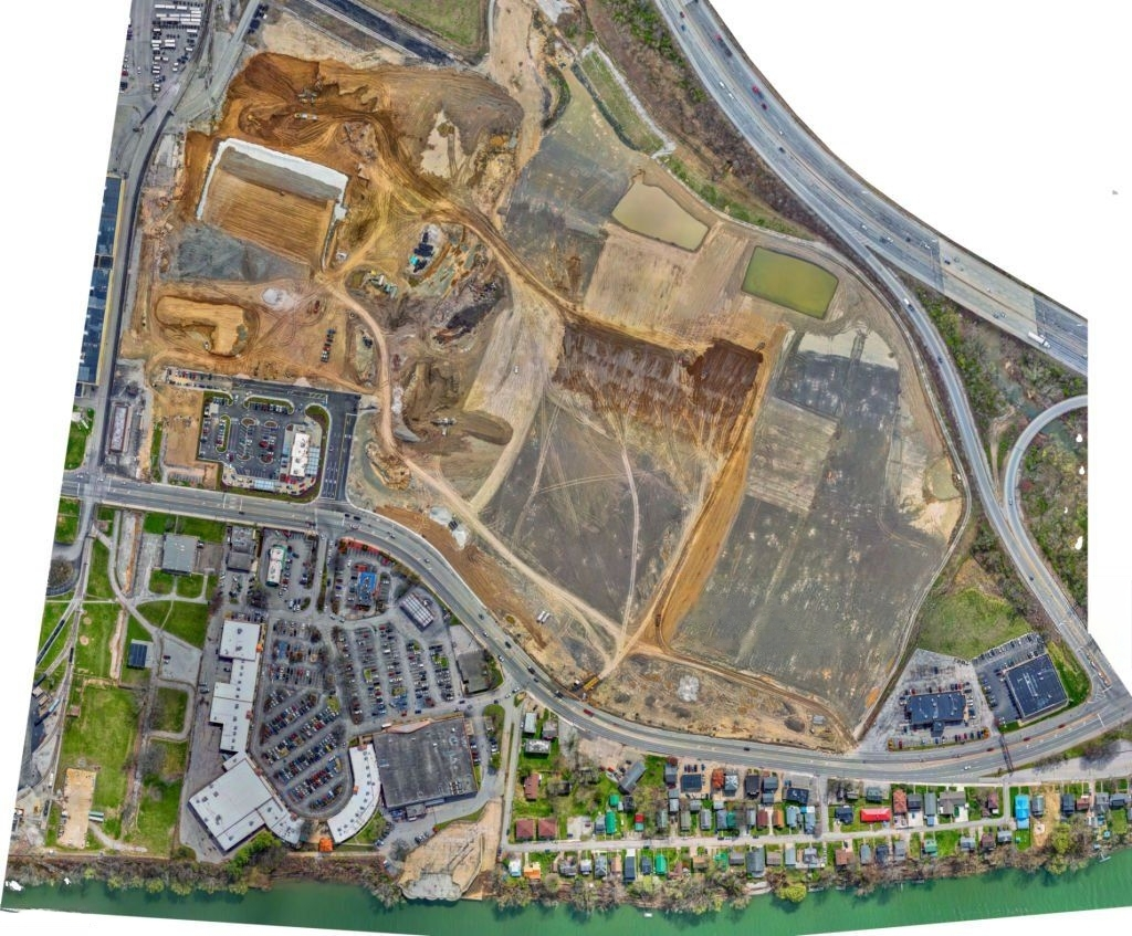
Benefits of Orthomosaics ?
-
Precision and Accuracy: Orthomosaics provide highly accurate visual data, enabling precise measurements and analysis.
-
Comprehensive Coverage: They offer a complete view of large areas, reducing the need for multiple surveys.
-
Time and Cost Efficiency: Drone-based orthomosaic capture is quicker and more cost-effective compared to traditional methods.
-
Improved Decision-Making: Detailed visual data aids in better planning, design, and monitoring of projects.
-
Environmental Insights: Detecting changes in vegetation, land use, and environmental conditions is made easier.
-
Historical Comparison: Orthomosaics allow for easy comparison of site conditions over time, aiding in progress tracking.
-
Enhanced Communication: Clear visual representations facilitate effective communication with stakeholders.
-
Safety: Minimizes the need for personnel to be on-site, reducing potential risks and hazards.


